The development of the level has gone through several significant stages, with its evolution closely linked to advancements in optical and electronic technologies. A detailed overview follows:
I. Origins (17th–18th Centuries)
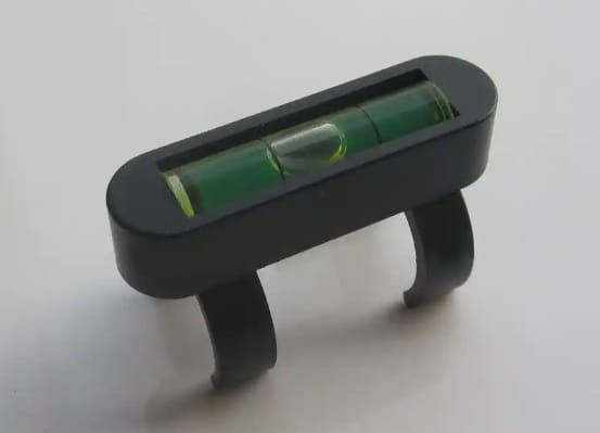
The emergence of the level was made possible by the invention of the telescope and the spirit level. Early levels featured simple designs—using a telescope to observe targets and a spirit level to determine the horizontal state—but offered limited precision and ease of use. Instruments from this era established the core principles of optical observation and horizontal referencing that underpin subsequent developments.
II. Tilting Levels (Early 20th Century)
Technological Breakthrough: Leveraging internal-focusing telescope and coincidence-reading spirit level technologies, the tilting level became the standard instrument in early surveying.
Working Principle: A tilting screw adjusts the pitch of the tubular spirit level in the vertical plane; centering the bubble (via a coincidence-reading mechanism) establishes a horizontal line of sight.
Characteristics: High sensitivity (due to fine graduation values on the tubular level), but complex operational procedures requiring repeated adjustments of the tilting screw and the coincidence-reading mechanism.
Application and Obsolescence: Widely used in academic instruction and basic surveying; however, due to low operational efficiency, it has been superseded by more advanced instruments.
III. Automatic Levels (1950s)
Technological Breakthrough: Introduction of an automatic compensator, utilizing gravity to apply minor positional adjustments to the telescope.
Working Principle: When the line of sight tilts, the compensator automatically adjusts the telescope’s position to quickly establish a horizontal reading; however, rough leveling using a circular spirit level is still required.
Characteristics:
Eliminates the need for precise manual leveling, simplifying operation and significantly boosting efficiency.
Stable precision; particularly suitable for environments with strong winds or significant temperature fluctuations.
Application: Became the primary instrument replacing tilting levels in modern surveying.
IV. Laser Levels (1960s)
Technological Breakthrough: A laser beam is directed into the telescope barrel and projected horizontally along the line of sight, enabling non-contact measurement.
Classification:
Dedicated Laser Levels: Standalone designs with integrated laser emission and reception systems.
Add-on Laser Units: Laser modules attached to conventional levels. Working Principle: A laser beam is emitted horizontally; it is used in conjunction with a leveling staff equipped with a photoelectric receiver target, with data read via the target.
Features:
High directionality allows for long-distance transmission, making it suitable for large-scale engineering projects.
Requires strict calibration of the coaxiality between the laser beam and the line of sight (collimation axis).
Applications: Widely used for transferring horizontal datums in construction, bridge, and tunnel engineering projects.
V. Electronic Level (Digital Level, 1990s)
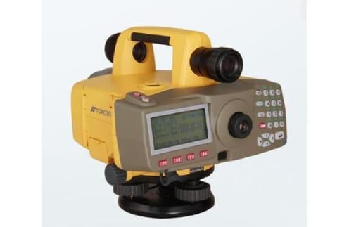
Technological Breakthrough: Built upon the automatic level, it integrates a barcode staff and a photoelectric sensor (CCD).
Working Principle:
After manual sighting and focusing, the barcode on the staff is imaged simultaneously onto the telescope’s reticle (for visual observation) and the CCD sensor (for electronic reading).
The electronic system automatically recognizes the barcode pattern and calculates the elevation difference, enabling digital data storage and processing.
Features:
High Precision: Electronic reading eliminates human error, achieving millimeter-level accuracy.
High Efficiency: Data is recorded automatically and supports real-time transmission to computers or mobile devices.
Compatibility: Can revert to automatic leveling mode when using a traditional staff, though accuracy is reduced.
Classification:
Precision Electronic Level: Designed specifically for high-precision measurement; lacks an optical micrometer, resulting in lower accuracy in standard mode.
General-Purpose Electronic Level: Balances accuracy and cost; suitable for most engineering scenarios.
Applications: Has become core equipment in fields such as modern surveying and mapping, geological monitoring, and deformation observation.
VI. Other Types
Old-style Tilting Level (Movable-objective Level): Early equipment that adjusted the horizontal state by moving the telescope’s objective lens; now obsolete.
Smart Level: Equipment emerging in recent years that integrates technologies such as GPS and inertial navigation to achieve automated measurement and data processing, though not yet widely adopted.
Summary
The evolution of the level reflects the trend of surveying technology shifting from manual operation to automation and digitization. From simple 17th-century optical devices to modern electronic levels, every technological breakthrough has significantly enhanced measurement accuracy and efficiency. In the future, with the integration of artificial intelligence and sensor technologies, levels will evolve further toward intelligent and unmanned operation, providing robust support for engineering construction and geographic information acquisition.