The instruments commonly used in leveling and horizontal surveying include the level, theodolite, total station, and steel tape.
1. Level
The level is one of the most fundamental instruments in leveling; it is primarily used to precisely measure the elevation difference between two points and to determine the elevation of specific points. By observing readings on a leveling rod through its telescope and utilizing its leveling mechanism, the instrument can accurately measure variations in ground elevation.
2. Theodolite
The theodolite is primarily used to measure angles, azimuths, and elevations. It can precisely measure horizontal and vertical angles, thereby determining the orientation of a target point. In surveying, theodolites are frequently used to establish the direction of survey lines and to perform angular intersection measurements.
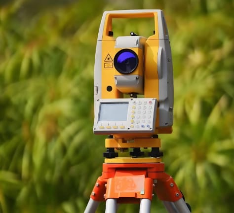
3. Total Station
The total station is a powerful surveying instrument that integrates the functions of a level and a theodolite, enabling the simultaneous measurement of angles, distances, and elevations. It incorporates electronic distance measurement (EDM), electronic angle measurement, and data processing systems, making the surveying process more automated and intelligent. Due to their high cost and comprehensive capabilities, total stations are typically employed for surveying tasks requiring high precision.
4. Steel Tape
The steel tape is a common auxiliary tool in surveying, primarily used for measuring shorter distances. It is often used in conjunction with a level or theodolite to determine the relative positions of points on the ground or to measure the length of survey lines.
In addition, with technological advancements, sophisticated instruments such as GPS (Global Positioning System) and CRT (Computed Radiography Technology) are increasingly being applied to surveying. By receiving satellite signals or utilizing other advanced technologies, these instruments enable higher-precision and more efficient measurements.