Surveying instruments are indispensable tools at various construction sites, including those for building projects, roadworks, and bridge construction. These precision devices enable engineers and technicians to accurately capture spatial data, ensuring that construction precision meets design specifications. There is a wide variety of surveying instruments used on-site; based on their functions and applications, they can be categorized as follows:
I. Total Station
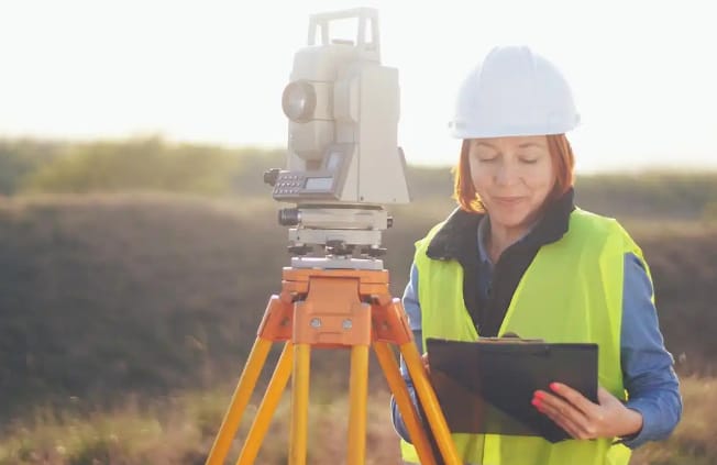
The total station is one of the most critical instruments in modern construction surveying. It integrates the functions of an electronic distance meter (EDM) and an electronic theodolite, allowing for the simultaneous measurement of horizontal angles, vertical angles, and slope distances. Using a built-in microprocessor, the total station automatically calculates and displays the 3D coordinates of measured points. Total stations on the market generally fall into two categories: optical and electronic. Electronic total stations are particularly popular due to their ease of use and high measurement precision (capable of millimeter-level accuracy). They play an irreplaceable role in high-precision tasks such as setting out high-rise buildings and tunnel breakthrough surveys. Some high-end models feature automatic tracking and remote control capabilities, significantly enhancing surveying efficiency.
II. Level
Levels are primarily used to measure elevation differences between points on the ground and are essential tools for controlling project elevations. Traditional optical levels are leveled using a spirit vial, after which elevation differences are determined by reading a leveling staff. With technological advancements, electronic levels have become increasingly common; they utilize electronic reading systems to display measurements digitally, thereby eliminating human reading errors. In road engineering, levels are used to control roadbed elevations, while in building construction, they are used to measure floor elevations. Precision levels can achieve an accuracy of 0.1 mm/km, fully meeting the requirements of various engineering projects.
III. Theodolite
Theodolites are primarily used to measure horizontal and vertical angles and serve as fundamental instruments in traditional surveying. Although the advent of total stations has reduced the frequency of theodolite usage, they remain widely employed in specific scenarios—such as monitoring deformation points over long periods—thanks to their simple structure and excellent stability. Modern electronic theodolites utilize photoelectric scanning for their graduated circles, automating angle measurement and greatly improving work efficiency. IV. GNSS Surveying Systems
Global Navigation Satellite System (GNSS) surveying equipment utilizes satellite signals for positioning; examples include the US GPS, China’s BeiDou, and Russia’s GLONASS. GNSS receivers can obtain the 3D coordinates of survey points in real-time, making them particularly suitable for large-scale, long-distance surveying tasks. In projects with open sites—such as highway construction and large-scale water conservancy works—GNSS systems are highly favored due to their high operational efficiency and the fact that they do not require a direct line of sight between points. The application of Real-Time Kinematic (RTK) technology has further enhanced positioning accuracy to the centimeter level.
V. Laser Surveying Instruments
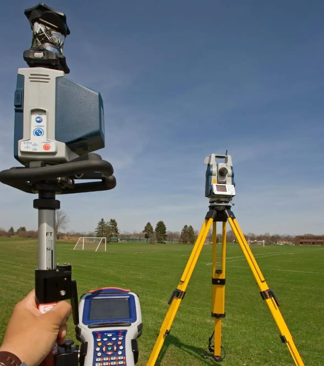
These instruments utilize the excellent directionality and monochromaticity of laser beams for measurement. They primarily include:
1. Laser levels: Emit horizontal or vertical laser planes; used in scenarios requiring extensive leveling work, such as interior decoration and pipeline installation;
2. Laser distance meters: Determine distance by measuring the round-trip time of a laser beam; easy to operate and suitable for quick, short-range measurements;
3. Laser rotary levels (or laser sweepers): Capable of providing both horizontal and vertical reference planes simultaneously; widely used in the construction of large industrial facilities.
VI. Specialized Surveying Instruments
In addition to the conventional instruments mentioned above, specialized equipment is used on construction sites based on specific requirements:
1. Cross-section profilers: Used for cross-sectional measurements in linear projects such as roads and ditches;
2. Convergence meters: Monitor deformation in underground projects like tunnels and foundation pits;
3. Inclinometers: Measure the tilt or inclination of structures or soil masses;
4. Rebar scanners: Detect the location of reinforcing bars and the thickness of the concrete cover within concrete structures.
In practical engineering applications, the selection of surveying instruments involves considering multiple factors:
1. Accuracy requirements: Accuracy demands vary significantly across projects; for instance, high-speed rail track surveying requires sub-millimeter accuracy, whereas centimeter-level accuracy suffices for earthwork;
2. Operational environment: Compact instruments are needed for confined spaces like tunnels, while equipment with strong anti-interference capabilities is required in environments with high electromagnetic interference;
3. Work efficiency: Instruments with a high degree of automation should be prioritized for large-scale surveying tasks;
4. Cost budget: The solution offering the best cost-performance ratio should be selected, provided that technical requirements are met. With technological advancements, modern surveying instruments are evolving towards greater intelligence, integration, and automation. Many instruments now feature wireless data transmission capabilities, allowing measurement data to be imported directly into Computer-Aided Design (CAD) systems and significantly reducing the need for manual intervention. Furthermore, the application of novel sensors and Internet of Things (IoT) technology has enabled long-term automated monitoring, providing a more reliable guarantee for engineering quality and safety.
It is worth noting that regardless of how advanced the surveying instruments may be, the professional competence of the surveying personnel remains the decisive factor. A qualified survey engineer must not only master the operation of various instruments but also understand surveying principles, devise appropriate surveying plans based on actual conditions, and accurately analyze and process the resulting data. Regular calibration and maintenance of instruments are also crucial steps in ensuring measurement quality.
On construction sites, surveying is integral to the entire construction process: from initial site leveling and foundation layout to the construction of the main structure, equipment installation, and final completion acceptance, every stage relies on precise measurement data. Indeed, the accuracy of surveying instruments directly impacts the quality and safety of the project. Therefore, construction entities must prioritize surveying work, equip themselves with compliant instruments, and cultivate professional surveying teams to safeguard this critical initial phase of construction.
Looking ahead, the widespread adoption of Building Information Modeling (BIM) and the development of artificial intelligence will lead to deeper integration between surveying instruments and digital construction, enabling more efficient and intelligent engineering surveys. Yet, no matter how technology evolves, the fundamental role of surveying instruments as a bridge between design blueprints and actual construction will remain unchanged; they will continue to be indispensable tools in engineering and construction.